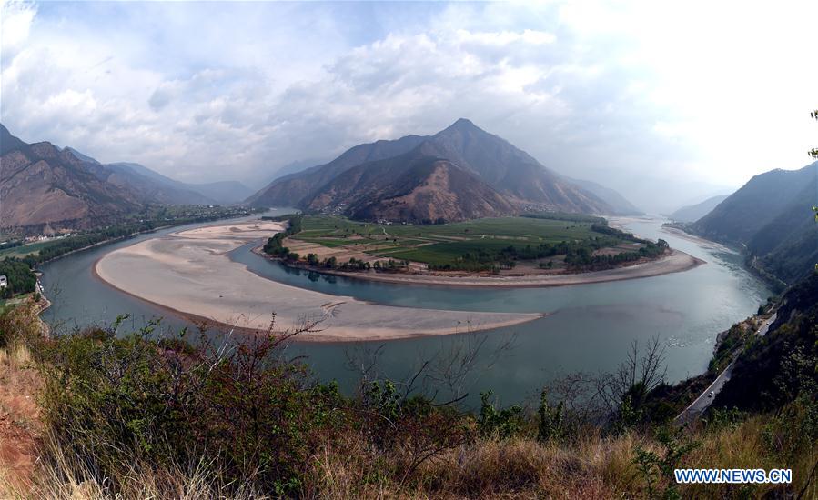
Photo taken on March 29, 2016 shows a bird's-eye view of Shigu Town in Yulong County of Lijiang, southwest China's Yunnan Province. The Yangtze, the world's third-longest river, runs through nine Chinese provinces and two municipalities, covering 2.05 million square km. The Yangtze River Economic Belt, which accounts for more than 40 percent of both the national population and GDP, is a new growth engine for the country, reducing the development gap between east, central and western regions. (Xinhua/Wang Changshan)
Aerial view of Yangtze River Economic Belt
Source: Xinhua| 2017-10-16 21:00:09|Editor: Zhou Xin
KEY WORDS:China
YOU MAY LIKE
-
China's first bridge across Yangtze River celebrates 60 years of service
-
Chinese province approves action plan to protect Yangtze
-
China to boost green manufacturing in Yangtze River Economic Belt
-
China makes progress in protecting water sources along Yangtze
-
China, Russia pledge to strengthen cooperation along Yangtze, Volga rivers
MORE PHOTOS