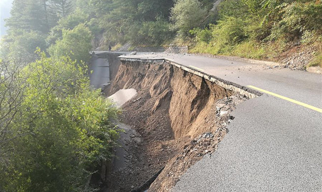
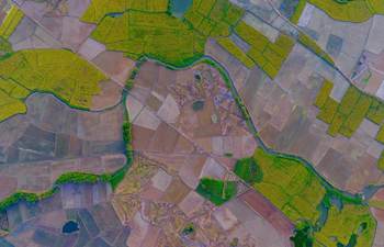
BEIJING, Aug. 10 (Xinhua) -- Satellite images show multiple landslides but no major collapse or damage of buildings near the epicenter of a 7.0-magnitude earthquake in southwest China.
The Institute of Remote Sensing and Digital Earth under the Chinese Academy of Sciences reported the findings late Wednesday after comparing satellite images of areas surrounding the epicenter near the town of ZhangZha in Jiuzhaigou County, Sichuan Province.
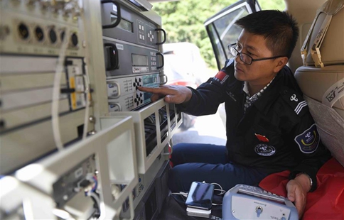
The institute said its remote sensing satellite ground stations began collecting data from China's Gaofen-4 and Gaofen-2 satellites early Wednesday. The data transmission rate reached 100 percent.
The two satellites are part of China's seven-satellite indigenous Earth observation program to be completed by 2020. Gaofen-2, for example, can see a meter-long object from space in full color.
The institute said the data will help researchers evaluate quake damage as soon as possible and assist in the rescue efforts.
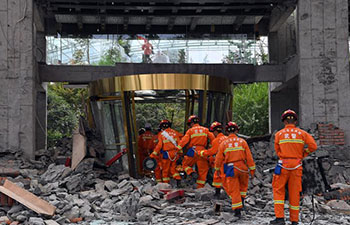
The powerful quake struck Jiuzhaigou at 9:19 p.m. Tuesday. As of 8 p.m. Wednesday, 19 people had been confirmed dead while 247 reported injuries, including 40 in serious condition.
Rescue operations are in full swing.
Perched on a plateau 2,000 meters above sea levels, Jiuzhaigou covers 5,290 square km and has a population of 81,000, according to a 2015 survey.
Jiuzhaigou is home to ethnic Tibetans and Qiang minorities and has a UNESCO nature reserve featuring turquoise and blue plateau lakes, stunning waterfalls and scenic mountains.
Many of the tourist sites suffered severe damage as landslides shoved mud and dust into the lakes, according to Xinhua photographers.