SAN FRANCISCO, April 13 (Xinhua) -- Researchers in the U.S. Pacific Northwest have developed an automated system to analyze the potential for rockfalls from cliffs onto roads and areas below, hopefully helping save money and lives.
Called a "rockfall activity index," the new methodology is based on the abilities of light detection and ranging, or LIDAR, remote sensing technology that uses light in the form of a pulsed laser to measure ranges, or variable distances, to the Earth.
It produces data on the "energy release" to be expected from a given cliff, that can be used to identify the cliffs and roads at highest risk, and to prioritize rock slope maintenance and mitigation efforts.
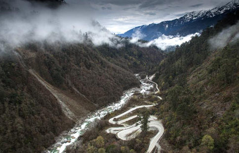
Rockfall is a multimillion-dollar global problem, and a particular concern in the U.S. Pacific Northwest with its many mountain ranges, heavy precipitation, erosion of steep cliffs and unstable slopes, and thousands of roads that thread their way through that terrain.
The evaluation system now most widely used around the world, a somewhat subjective, time-consuming process to determine how dangerous a cliff is to the people, vehicles, roads or structures below it, was developed by the Oregon Department of Transportation more than 25 years ago.
The new technology should improve on that approach, according to researchers at the University of Washington (UW), Oregon State University (OSU) and the University of Alaska Fairbanks. "As a low-cost, high-resolution landslide hazard assessment system, our rockfall activity index methodology makes a significant step toward improving both protection and efficiency," said Joe Wartman, associate professor of civil and environmental engineering at UW, and corresponding author of a study published in Engineering Geology.
The new approach could replace the need to personally analyze small portions of a cliff at a time, looking for cracks and hazards, with analysts sometimes even rappelling down it to assess risks.
LIDAR analysis can map large areas in a short period, and allow data to be analyzed by a computer.
"This should improve and speed assessments, reduce the risks to people doing them, and hopefully identify the most serious problems before we have a catastrophic failure," co-author Michael Olsen, an associate professor of geomatics at OSU, was quoted as saying in a news release from UW.
The technology is now ready for use, the researchers said, although they are continuing to develop its potential, possibly with the use of flying drones to expand the data that can be obtained.