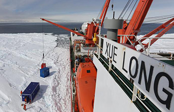
SYDNEY, Dec 12 (Xinhua) -- Australian scientists have found a creative new way to examine biodiversity on the Antarctic seafloor, with research published on Tuesday, outlining how satellites can be used for new ocean models.
The groundbreaking discovery from the Institute for Marine and Antarctic Studies (IMAS) enlisted the help of a number of organisation across a range of disciplines including earth sciences, physics, geology and biology, in an attempt to understand more about how to manage Antarctic's oceans.
"The concept of how the model works is really simple," lead author from IMAS Jan Jansen told Xinhua.
"Satellites are used to measure the amount of algae on the surface water and what we then do is use the ocean current speed and direction, to predict where the algae will end up on the seafloor."
This means that for the first time, scientists will be able to predict how much food is available to organisms on the Antarctic seafloor, giving researchers a better understanding of how much life can be supported in the region.
"The model we have developed is important because we can use it to identify areas that may have high conservation value in the Antarctic," Jansen said.
"And that is crucial because often these locations are very difficult for scientists to access due to sea ice."
"We can also use it to discover new hotspots of marine life that we may not have known about and it also gives us a tool to examine how climate change may effect environmental factors like food."